


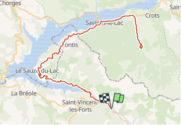
2016-06-14 Boscodon - Le Lauzet Ubaye

Lucquiaud
Gebruiker

Lengte
61 km

Max. hoogte
1154 m

Positief hoogteverschil
1520 m
Km-Effort
81 km

Min. hoogte
771 m

Negatief hoogteverschil
1520 m
Boucle
Ja
Datum van aanmaak :
2018-09-15 15:05:04.875
Laatste wijziging :
2018-09-15 15:05:05.853
4h36
Moeilijkheid : Moeilijk

Gratisgps-wandelapplicatie
 SityTrail
IGN / Geografische instituten
SityTrail Plus
De wereld gaat voor u open
Over ons
Tocht Fiets van 61 km beschikbaar op Provence-Alpes-Côte d'Azur, Alpes-de-Haute-Provence, Le Lauzet-Ubaye. Deze tocht wordt voorgesteld door Lucquiaud.
Plaatsbepaling
Land:
France
Regio :
Provence-Alpes-Côte d'Azur
Departement/Provincie :
Alpes-de-Haute-Provence
Gemeente :
Le Lauzet-Ubaye
Locatie:
Unknown
Vertrek:(Dec)
Vertrek:(UTM)
294303 ; 4924038 (32T) N.
Opmerkingen